International Cartographic Exhibition – OUT OF THE COMPETITION

ITALY
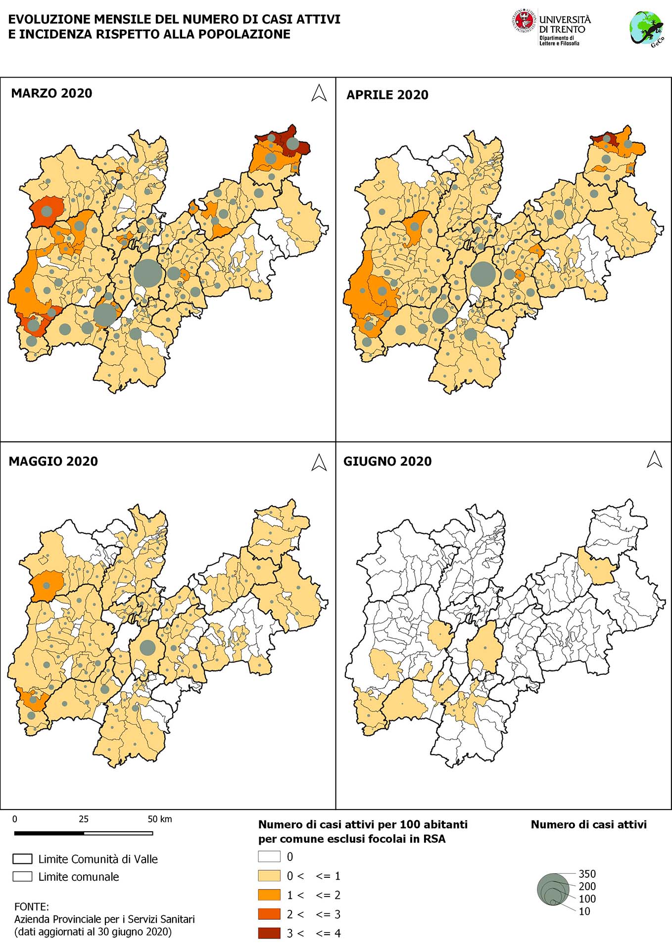
Covid-19 in the Province of Trento
ITALY
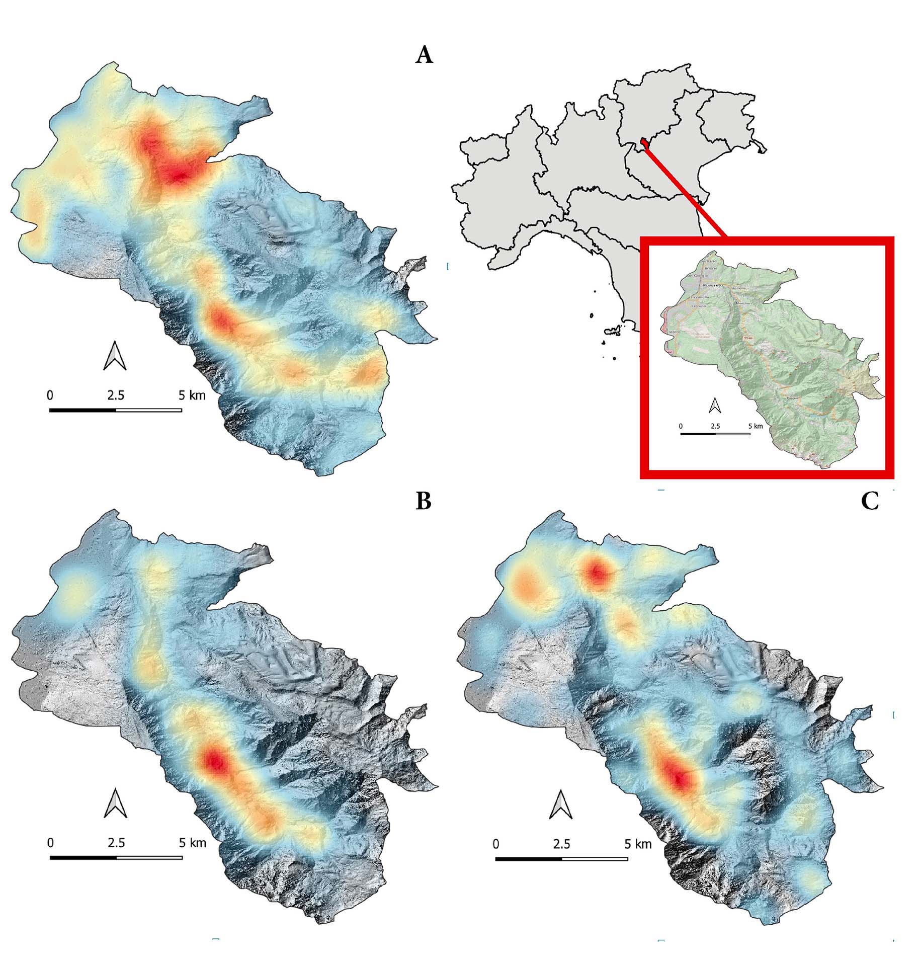
Heat map of places names distribution in historical maps (A: 2007; B: 1853-61; C:1901-05). The case study of Rovereto-Valli del Leno (Province of Trento, Italy)
ITALY

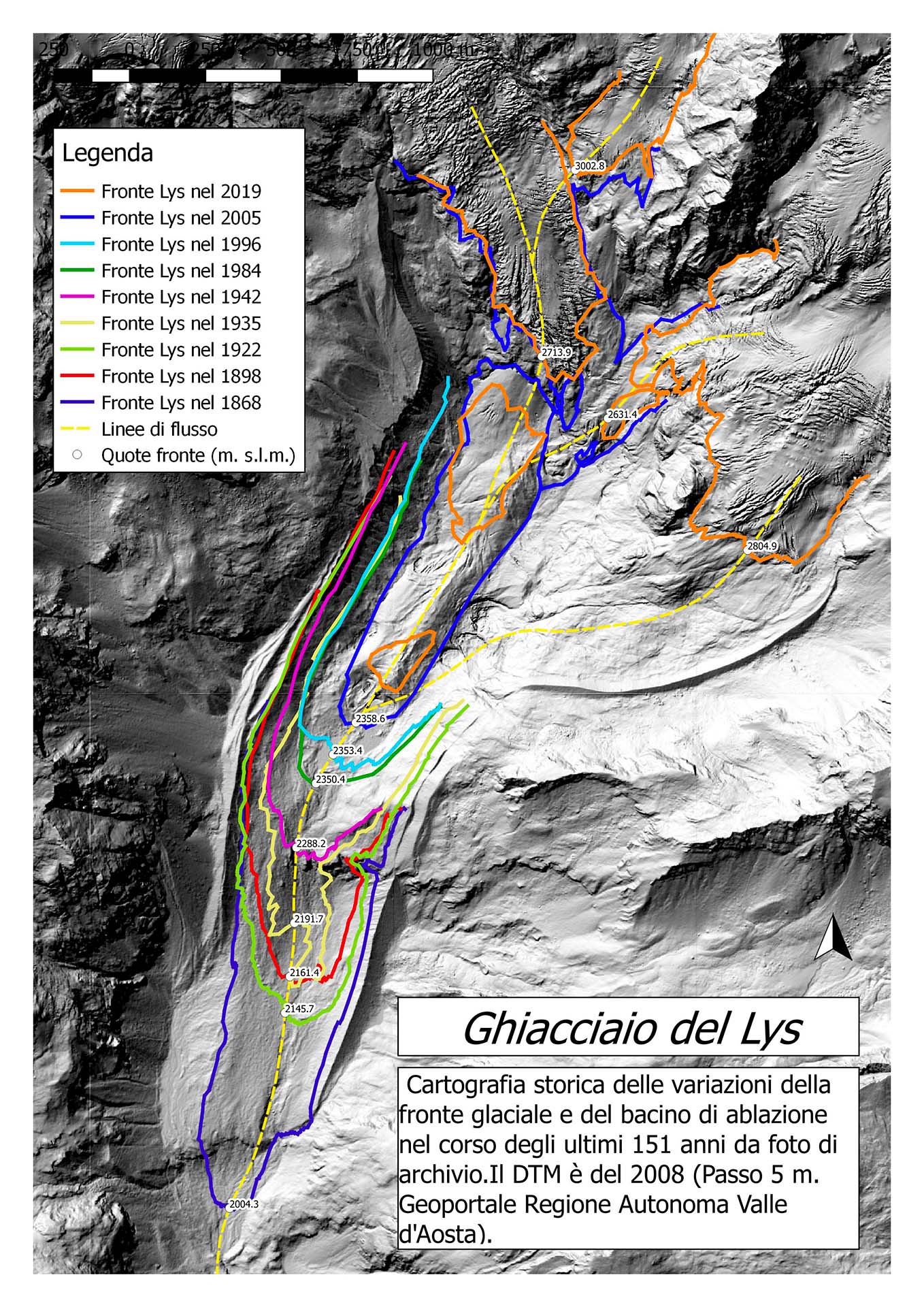
Lys Glacier. Dyachronic cartography of the terminus variations
ITALY
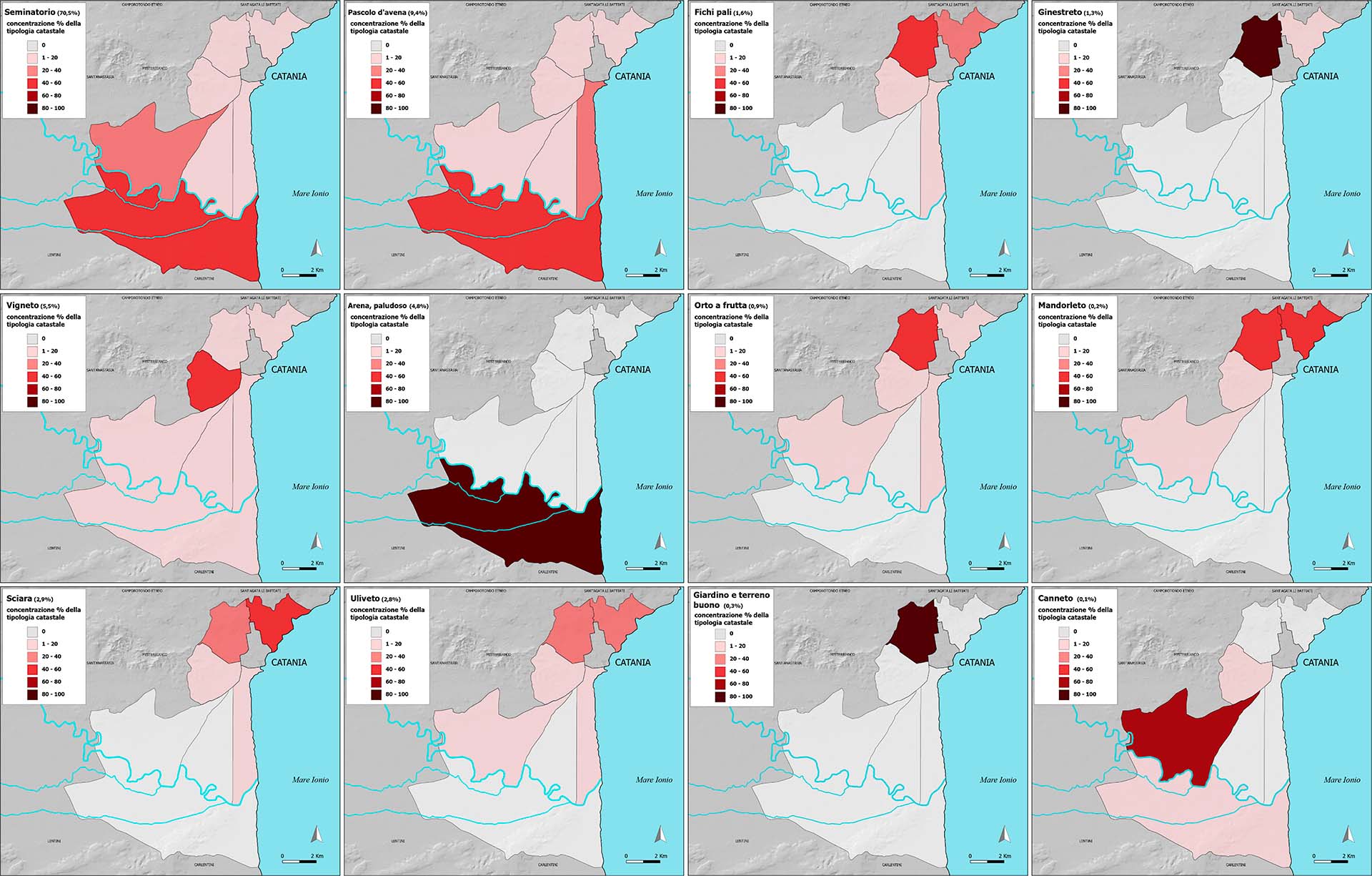
Representing Territory. Mid-Nineteenth-Century Land Use and Crop Types in Sicily: A Digital Geohistorical Approach to the Descriptive Cadastral Source
Covid-19 in the Province of Trento

Click on image to zoom
Heat map of places names distribution in historical maps (A: 2007; B: 1853-61; C:1901-05). The case study of Rovereto-Valli del Leno (Province of Trento, Italy)

Click on image to zoom
Lys Glacier. Dyachronic cartography of the terminus variations
Click on image to zoom
Representing Territory. Mid-Nineteenth-Century Land Use and Crop Types in Sicily: A Digital Geohistorical Approach to the Descriptive Cadastral Source

Click on image to zoom
POLAND
The Global North-South Atlas. Mapping Global Change.
The Global North-South Atlas. Mapping Global Change.

Click on image to zoom